Before Tripadvisor, and even before the Michelin Guide, the ancient Romans had the Tabula of Peutinger.
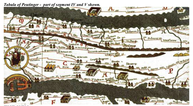
The Tabula of Peutinger (also known as Tabula Peutingeriana) is one of the world’s oldest maps. Rather than being to scale and of true cardinal orientation, this map is more of a road map or traveller’s guide to the known Roman world at the height of its expansion in the late 3rd century AD.
Intended for use by government officials, the map contains useful information about state-run facilities and key points of interest throughout the Empire. Made up of 11 original segments it is the result of successive copies and overprints carried out at various times from several ancient originals.
Historians believe the oldest sections of the map date back to before 79 AD, the year that Pompeii was destroyed by Mount Vesuvius’ most devastating eruption.
A stunning facsimile is on display at the Australian Armour & Artillery Museum as part of the Cairns Italian Festival.